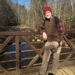
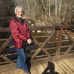
Day 1 – Wednesday, January 22, – Latief to Avon
Since returning from his hospital stay in Bangor that ended his trek in Maine last October, Larry has been working on getting off of the medications that team of Cardiologists prescribed. One can’t just stop taking them, but he needed to solicit approval from Ahmed Latief, his home Cardiologist. He had an appointment with him on October 9 at which the adjustment of his new pacemaker was corrected, but his appointment for December 4 was postponed until today. In the meantime he consulted with Tom Seasly, his primary physician, about the situation and Tom scheduled him for an Echo Cardiogram on December 4 and his report showed Larry back to his April 2023 heart function. Dr. Tom even said that the doses of the standard “congestive heart failure medication soup” that was prescribed were so low and the Echo results confirming no issues that if it were up to him he would have Larry drop all of them. So now the heat was on and the moment was at hand. Just as Dr. Latief entered the room for his visit after a wait of 90 minutes an emergency with a patient on a treadmill stress test, which also involved a defective pacemaker ensued and off he went to put out the fire. When they resumed their interview Larry stated his case – no symptoms, the diagnosis of congestive heart failure was remanded to pacemaker-induced cardiomyopathy, the December 4 Echo results showed normal heart function. Dr. Latief said to him, “You would make a great salesman and you are presenting a convincing argument. I have no problem with dropping the Jardiance ($600/month copay, the biggy), and I wouldn’t mind your blood pressure being a bit higher because of your moderate atrial stenosis so you can drop losartan, but the metoprolol (a beta blocker) I want you to keep to help keep your heart calmed down; but if you stop and have no issues, fine.” The magnesium Dr. Latief prescribed in October didn’t come up. Larry researched his test results for the past six years and it has always been in the acceptable range, so out it goes as well. No test result on the Vitamin D3 yet, so still letting that supplement dilute out of his system. With this Larry went from 7 pills in the morning down to two – atorvastatin and low-dose aspirin. Freedom at last. And with that two and half hour doctor visit we were off in wonderful but very frigid driving weather to Avon.
Got a low left front air pressure on the way and fixed that at the J&J market by Grissom AFRB north of Kokomo. Mary Ann ate lunch in the car. No big shakes happening in Avon, just crashing with the grandchildren, petting the cat and making sure no liquids in glass were left in the car to freeze and burst. Had a panic finding Larry’s car keys and remaining daily drugs. A panic over something misplaced is so much a daily occurrence anymore, really.
Day 2 – Thursday, January 23, – Avon to Wears Valley TN
Wonderful driving weather on a very frigid day. Zoomed comfortably past snowy fields, forests and houses in sparse traffic. Stopped at our usual Waffle House in Lexington KY and had a great lunch. Gotta love he wait staff at Waffle House, they make it worth the trip. Got to the Pigeon Forge at 3:20pm – made good time without any traffic issues. Got the few groceries we had on our list and headed to the Tennessee Rose AiRBnB. Roads were clear of snow and it was in the high 20’s. Things got interesting here as the door lock code wouldn’t work, nor did the garage door code until Larry got more serious with the keypad. In the end we had to call the Owner and the AirBnB Help number to get an new code, which worked. In the hour meantime Larry figured out how the code worked from the basement door into the house, which the new owners haven’t changed in five years from what was taped to the inside doorknob by the Voisins (previous Owners), so in the future we should be able to get in no matter what.
Unpacked, set up and ate a Cincinnati chili dinner. Big improvement for the house was a new shower faucet on the main floor replacing the old one that stuck so badly Larry had to yank it on for Mary Ann each time. Still have the same miss wired switches for the main room chandelier and bedroom ceiling lights – appears that they were intending to put in multiple speed ceiling fans, but got confused on which hot wire was for which – fan or lights – and wired these lights into the 3-speed fan knob style switches anyway. They work but hardly seem compliant with the National Electrical Code. In the bedroom the regular switch runs the fan. Just a bit strange.
Meanwhile Larry was nearly scammed about a month ago by a well aimed fake Xfinity update email. He stopped short of giving any personal info but it has been haunting him a bit since. So when he got a notice from Xfinity of a log-in on his account today while we were driving, he figured he needed to do some password security work this evening. The notice was legitimate as far as he could determine. Changing email passwords from a smart phone is a pain, especially when it’s been so long that you don’t remember how to do it. He got his laptop into it and that helped. But then he fat-fingered a long password and botched up his email access, all the while trying to send out a Boy Scout related email. It didn’t help that Microsoft Outlook no longer supports gmail either, which is Larry’s email recovery back up. That cold sweat and feeling in your stomach that you will never recover your email account starts to creep in, and maybe the hackers are intercepting your email changes anyway. Aaaaah! Finally at midnight having pretty much verified that the password changes had happened correctly he gave up, shut it down and went to bed.
Day 3 – Friday, January 24, – Hiking the Old Sugarlands Trail
Larry finally rolled out of bed at 8:15 after a late night, but we both slept well. Larry purposely didn’t look at the email situation, but noted that he had received a few spams already since last night that proved the comcast email was running. Spam can be useful.
After prayer a nice eggs and bacon breakfast. That’s when we discovered there was no spatula/turner in the house and no salt or pepper, like there always has been in the past. Also no house coffee. We found a wooden spatula finally that worked sorta, and Larry had brought his four favorite coffees with him. Larry handled the no turner problem by going to scrambled from omelet; Mary Ann toughed out her omelet with mixed results. Could have used some salt and pepper, however.
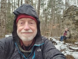
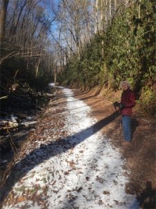
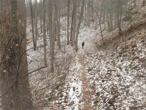
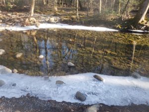
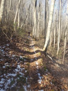
No snow or rain overnight with temps in the mid-20’s. We first needed to get to the Sugarlands Visitor Center and get an update on park road closures, and this necessitated driving into Pigeon Forge and around Gatlinburg. This fit right into our need for the salt and pepper at Kroger’s and a spatula from Dollar General on the way. At the visitor Center we found things were better that earlier reported. We’d have access on Little River Road to the Townsend Wye and on eastward into Cades Cove. So we could lay out a pretty normal dayhike plan going forward. Since by now it was already 1230 we opted for the Old Sugarlands Trail that begins from the Visitor Center and follows the Little Pigeon River eastward. The trail was free of snow but the rocks in the stream
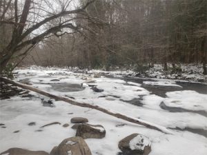
and surrounding forest floor were snow covered. The temperature was in the mid-30’s and got above 40° by the time we returned back to the car. This is a great little hike along the stream most of the way, mostly flat. We made the 1.4 miles to the old CCC Camp and back with our usual lunch at the outbound destination. A wonderful meal of vegetable and black bean soup with chunked spam added, crackers, dates/raisins trail mix and hot tea. All the while sitting on a log in the snow. Perfect. Bare hands really bear most of the suffering in this scenario. On the way back to camp we stopped at Kroger again, this time for wine.
Back at camp we grilled some pork chops with red cabbage and sweet potatoes. Something went wrong with the chops, likely in their thawing in the microwave or maybe with the grill temperature, because they were really tough and were cooked past medium rare in 5 minutes on the grill. Real chewy they were, but we toughed it out. After dinner Larry fell to typing this blog, and we were in bed by 11pm. He verified that the email was running normally and nothing had been touched at our Xfinity account.
Day 4 – Saturday, January 25, – Hiking to the White Oak Sink
Larry sandbagged it again this morning, while Mary Ann all chipper was up and got the lunch for today all set up. By 10am we had prayed and eaten breakfast and were in the car headed to the Townsend Wye and up Laurel Creek Road to the School house Gap trailhead. Temperature first thing was near 25°. We had beefed up our clothing from yesterday and were toasty more or less outbound. Mary Ann reported that her hands always get cold. The sun was out brilliantly for the hike.
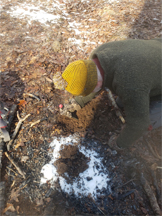
Larry smelled smoke in Dorsey Gap near the junction with the Turkeypen Ridge Trail. Looking around he found a smoldering campfire right next to the trail. Sure, the fire risk with snow on the ground is nearly zero, but this indicates great negligence plus poor outdoor skills and knowledge. Larry put to getting it dead out, first digging a hole, then burying the coals and then piling snow on the top of the hole. In a dry October this could have been very bad.
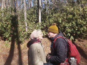
One of the well kept secrets of the Smokies hikes is the dead end White Oak Sinks trail that spurs off of the Schoolhouse Gap trail just uphill from the latter’s junction with the Turkeypen Ridge Trail. The trail ends in a flat meadow-like area at the base of a ridge to the west, which has a cave. It is not listed in the park trail guide, not shown on the park trail map and has no sign at its beginning except a “No Horses Allowed” warning and a manway to prevent entry by said horses. We hiked this last in April 2016. Winter weather scenery today. We hiked in about a half mile from the Schoolhouse Gap trail and finally called a halt for lunch. So we had gone about 1.5 or 1.6 miles from the Schoolhouse Gap trailhead, a respectable distance and farther than yesterday.. found nice area and butt log with just a trace of spotty snow. On the return trip were caught by a couple from behind (younger, or course) that we had seen ahead of us outbound and learned we should have kept going a bit farther to the actual sink. Larry’s memory had failed him. Also met another local couple who confirmed that it was indeed a dead-end trail. Examining our Zoleo route Larry confirmed that we were nowhere near a junction with the Turkeypen Ridge Trail to the south running in the same general direction. We were satisfied with the hike.
Back at the ranch we crashed for an hour nap before getting ready for church. We left a bit late but got there 5 minutes before the start. And to our delight the pastor was still Fr. David Mary Ingo, the barefoot Franciscan, and the Voisin’s were doing the music. Holy Cross parish in Pigeon Forge is a gem in the rough, surrounded by the glamour of our current secular culture. We don’t know how the other weekend Masses are, but Saturday evening with the Voisin’s doing the music and Fr. David Mary preaching is worth the trip south just for that alone. What a blessing. Spoke with the Voisin’s a bit after Mass. Returned to camp for our Lord’s Day with pre-made pot roast, and ice cream for dessert.
Day 5 – Sunday, January 26, – Hiking to the Finley Cane Hitching Post
We are in a bit of a rut this trip, as we can’t seem to break out from under the covers before 8:15am. But this is a vacation and maybe we’ve finally got it right being ore laid back.
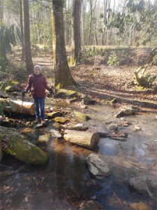
This morning broke with another cloudless sky and the promise of temperatures in the 40’s. Since the Laurel Creek Road we discovered back on Friday was open that gave us access to the Findley Cane-Lead Cove trailhead and that is where we headed after prayer and breakfast. We were ready to hike at 1130 and made the first rock hop crossing over Sugar Cove Creek at 1140. We did this one a few years ago at HIGH water using a downed beech tree (still visible but not longer obstructing the ford). Of course the thought of several hours of wet, cold feet with one missed step adds plenty of anxiety to the challenge, not to mention the embarrassment and threat of getting really wet from a fall. Today was not an issue. This is a 2.8 mile contour following trail with not much elevation gain or loss from Laurel Creek Road up to the Bote Mountain trail that we have done several times as a loop back to the car on the Lead (pronounced like the metal) Cove trail, but this trip being largely out of shape we made getting to the hitching post at 2 miles and back our goal. Still, a longer hike than yesterday by about a half mile.
The forest floor had a thin layer of snow with the brown leaves poking
through. The air was still and after about 100 yards into it the road noise was gone. Much of this trail is lined with rhododendrons or covered in rhododendron tunnels, so come May this hike is spectacular. At roughly 0.5 mile in you get to the back-to-back steam crossings of Laurel Cove Creek and its Hickory Tree branch, not to be taken lightly and just as wet as Sugar Cove Creek. They are about 200 yards apart and the water level today gave just enough exposed rocks. Hiking poles are also always a big help. Any mathematician will tell you that three points determine a plain, and with only two legs, one of which is in the air taking the next step, you only have one point without the two poles. Two feet on one tiny rock mid-stream don’t work well usually.
We are no longer the fastest party on the trail. Lost in his forest reverie Larry heard an “excuse me” from the rear that surprised him and he actually jumped as some 50-something fella breezed by. There was a time when that didn’t ever happen, backpack on or no pack. Cue in a groan and a sigh.

We made it to our destination and set up lunch. There is a rockpile fire ring at the hitching post that provided plenty of flat rocks for sitting and setting the stove on for the cooking. Today’s choice of soup left something to be desired. The label described it as having a “a savory chicken bone broth with vegetables and dark meat chicken.” Should have noticed two things – bone broth as listed first and chicken second and there was a typo on “vegetables” – this should have been “vegetable” singular. To add to this less than desirable situation, it had a traditional can top that needed Larry’s knife can opener. All part of the marriage adventure, indeed.
We did notice that our hands weren’t as cold on the return to the car and noted the temperature on the car thermometer was 43° when we returned at 3:30. so with the hour for lunch we hiked for roughly 3 hours and covered 4 miles.
Once back at the cabin we just took our Ibuprofen and crashed. Larry grilled hamburgers. These turned out way better that the pork chops now that he had more of a feel for the grill temperature and cooking time. The grill is very shallow and he found leaving the lid open worked better at moderating the temperature. The knobs of this unit are low to max in a quarter turn, not allowing much adjustment between max on and off.
Day 6 – Monday, January 27, – Birthday, Rain Day; Scrapbook Day
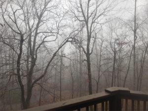
As was forecasted we awoke to rain and immersed in clouds. One look out the sliding glass doors and our day was decided. All part of the usual plan. We needed a break from hiking anyway.
Up at 8:30 per usual and done with prayer and breakfast by about 11 after answering emails to keep things we’re responsible for back
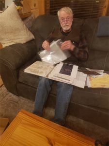
home moving. At around 11 we broke out the accordion file with last year’s (2023) momentos and dove in. The main feature was hiking. Dad took 3 AT hikes last year – two in Pennsylvania (June), one in New York (August) and one in Maine (September). Added to these were Sarah’s volleyball at Circle City and Avon, Sarah’s Avon orchestra and the usual birthdays and anniversaries. The process involves trimming, arranging and fitting to the page at the only table in the house, then spray gluing and mounting on the 8-1/2 x 11 sheets
downstairs on the pool table, then assembling the pages into the page protectors and then ordering them into the binder. We bring a tarp to cover the pool table. It’s always fun remembering the various events and talking about them in the middle of this tedium. We were ready to organize the mounted pages into the protectors by dinner time and finished getting them in order soon after.
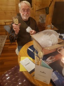
Then came the birthday dinner and celebration for Larry, the big double 7, with wine and dessert. Mary Ann gave him the two Yuengling beer glasses ha had left from his Christmas gift list and a very sweet card.
Day 7 – Tuesday, January 28, 54th Anniversary
Who’da thunk it? Here we are one day short of arriving for our Honeymoon on January 29, 1971. The day broke as it should have to honor us bright, sunny and warm. Our hike today was the 2 miles along the Little Pigeon River from the Visitor Center into the near end of Gatlinburg to Calhouns for lunch. No hiking poles, no packs, no lunch on our backs. Just a wallet with a credit card. We got a late start to say it politely, starting the trail at around 12:30 with lunch at 1:30. Air temperature was in the low 50’s.
Headed to Calhouns Restaurant for lunch. They were not busy at all, but we got seated by a table of eight orientals. Our waiter, Simon, had them as one of his tables, but he was savvy enough to get our order out first. Even at that it took an hour for our food to arrive. Mary Ann had a huge Caesar salad with chicken, Larry had unbreaded wings and a Helles lager, one of the Calhouns house beers. Got talking to Simon, who was an older fella, and learned he’d been there only 3 months after being let go by TGI Fridays across the street that closed down. No severance pay or anything after 5 years there. He was wearing a cross and we commiserated with him and prayed with him briefly for God’s grace.
After lunch we headed back to the car taking pictures of the snow in the Little Pigeon, arriving at the car around 4:15. The back to the cabin. We decided to postpone our anniversary dinner out until tomorrow rather than turning right around and driving into Pigeon Forge. We exchanged our gifts we had smuggled down in the car, had some wine and dessert. Very cozy and nice. Larry got some new Eddie Bauer winter gloves and Mary Ann some Duluth Trading lined winter pants.
Day 8 – Tuesday, January 29, Elkmont Village and Meigs Mountain Trail
Went to bed last night trying to figure one last easier trail to cope with Mary Ann’s back and Larry’s lack of conditioning and woke up with the answer – the Jake’s Creek trail and parallel contour Meigs Mountain Trail from the Elkmont Village trailhead. The Park has been slowly restoring this historic original summer time community for 5 years or so now, and a number of the buildings are accessible very well done. They have also left a series of original chimneys along the approach to the Jake’s Creek trail. We got there at about 1030 and hiked up the hill past the old chimneys to the start of the Jake’s Creek trail, ten took the old service road to the horse stable and then the spur trail that intersects the Meigs Mountain trail and off on that trail for all included an hour and a half, then set up for lunch at 1210 or so. The weather had gotten progressively more balmy as the morning wore on and by lunch there was no snow cover left
at our trailside lunch location. We had the usual chicken soup, a much better rendition than that on Sunday, crackers, dried fruit and hot tea, then tarried awhile enjoying the warmth and sun, then headed back to the car. Made it back to camp by 3pm. Larry did some emails and then we spruced up to go out for our anniversary dinner in Pigeon Forge at Puckett’s BBQ.
Oddly, Puckett’s doesn’t offer BBQ ribs along with the usual brisket and pulled pork, so we both had the brisket, which we found quite good. Larry had their house Lager and that was very good as well. Our portions were large enough to bring home a bit of brisket leftovers.
Back at camp we fell into finishing up our packing for tomorrow’s departure and consuming the leftover ice cream, milk and other food stores rather than carry them home or throw them out.